We set out this past summer on an epic roadtrip across the United States in order to get to know my own country better and see many of the places that I had learned about in elementary school geography class, but still had never seen in real life.
Of all 17 of the states that we traveled over the course of 2 meses, without a doubt the biggest surprise was Utah. Zooming up Highway 491 with our destination set to Moab, it wasn’t 30 minutes after crossing the Utah border that the landscape became downright extraño. From that moment, until exiting on the other side of the state 2 weeks later, I was completely blown away by Utah’s unique geography. I had no idea that landscapes like this existed in my own country. En realidad, I had no idea that landscapes like this existed on this planet. And no amount of photos on the internet, taken with the best cameras around, and masterfully edited on the computer can accurately capture what I’m talking about – you simply have to see Utah in real life to believe it.
Aquí están 6 places that prove Utah is from a different planet (not really, but you get the idea):
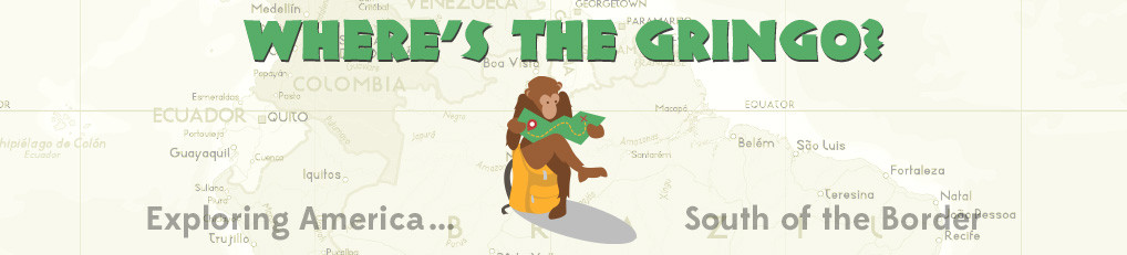
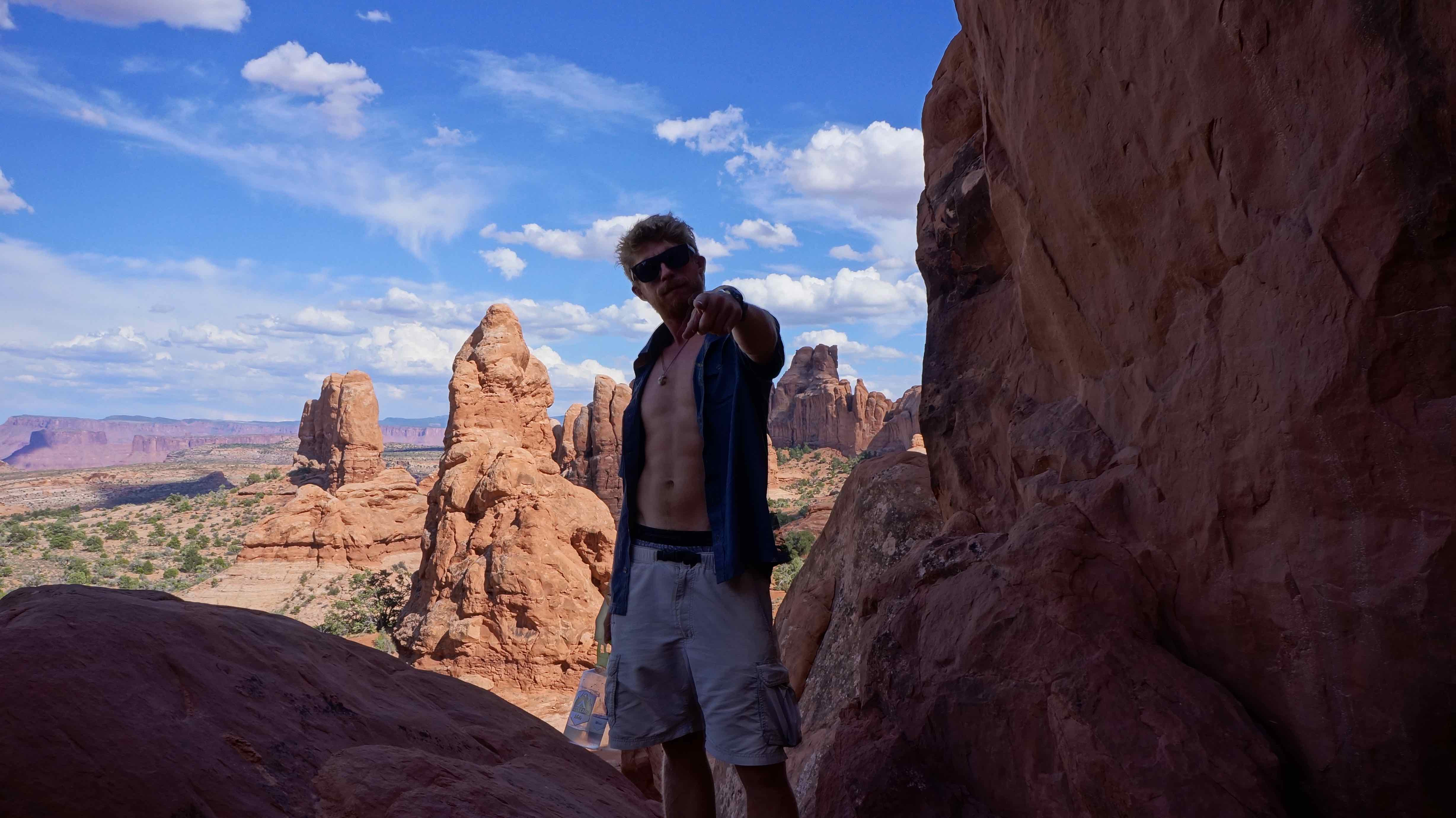
Parque Nacional Canyonlands – Agujas Distrito
You ever go crazy with the icing gun when making a cake?
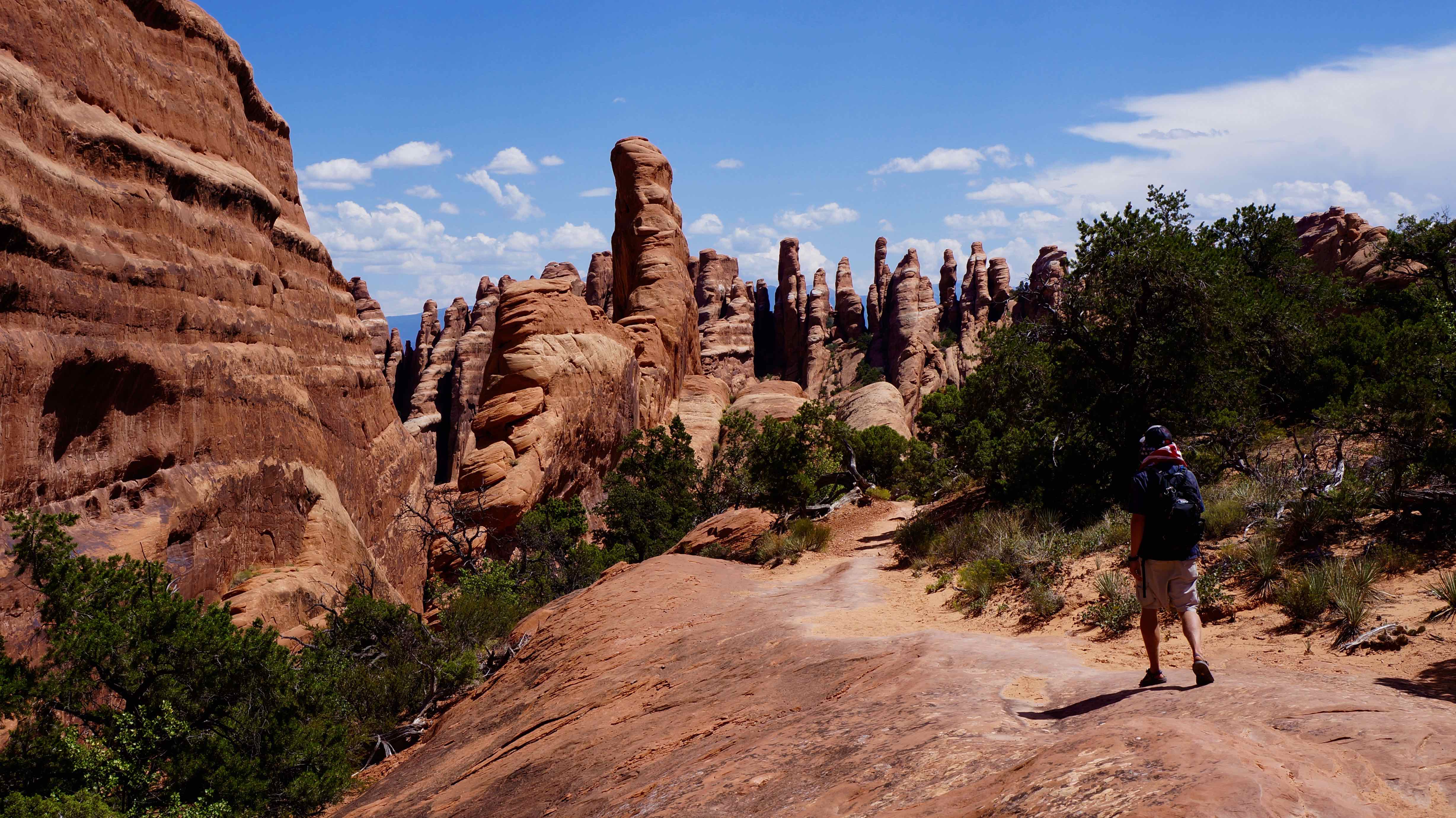
If Utah were a cake, the Needles District would be where God himself got a little insane with the icing gun. A little dab here, a mushroom-head blob there, a few sporadic squeezes of the red-rock icing over there.
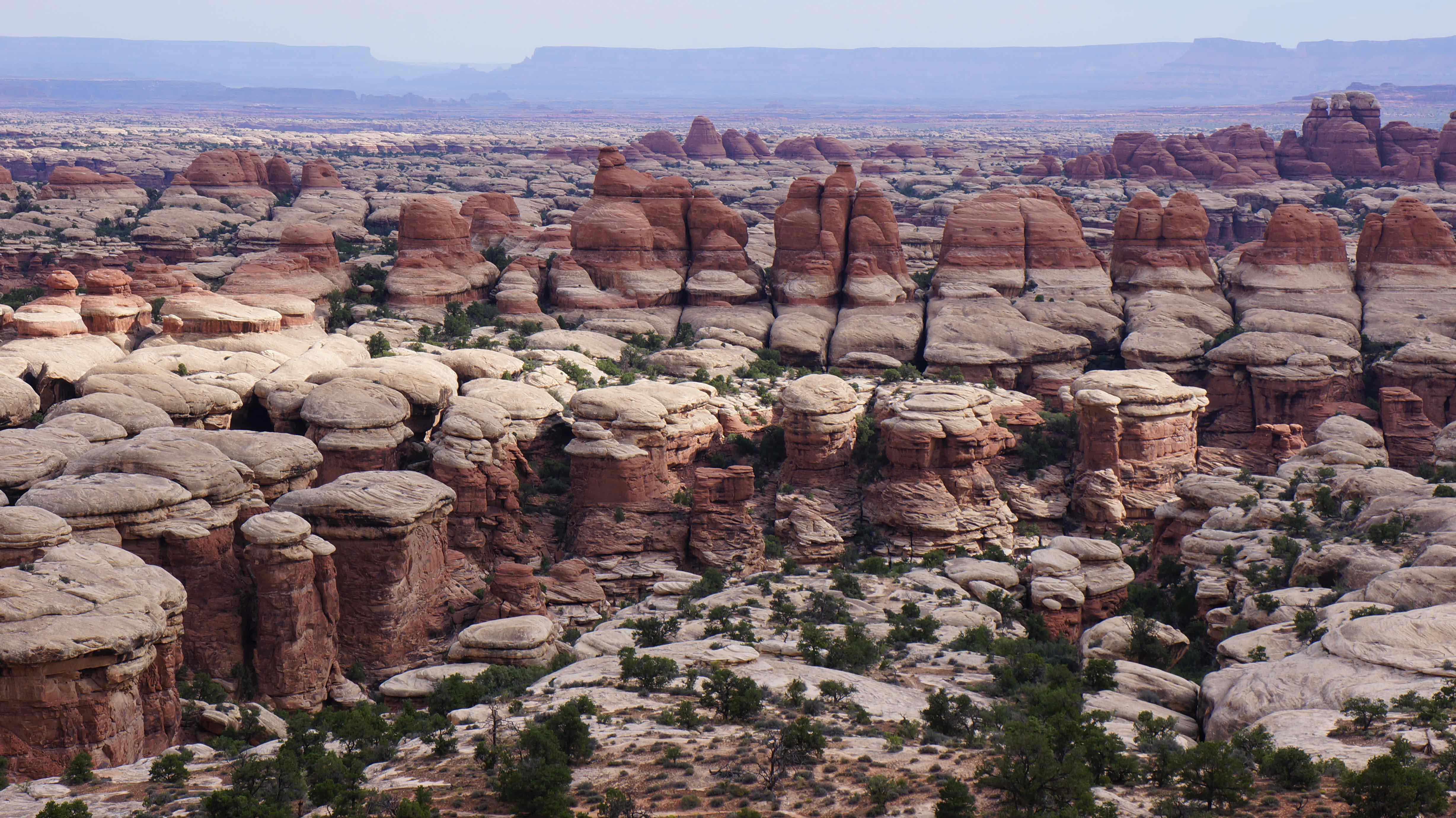
An area called Chesler Park is especially mind-boggling. Was this some sort of lost Super Mario World level that I stumbled into? Does going to Utah unlock a special cheat code to the game of life?

Suggested time: 2 days
Lo que hicimos:
Chesler Park para bucle Trail Conjunta – 11millas (18km)
Una caminata de dificultad moderada. Take a couple hours to do some boulder jumping, trekking through washed out river beds, and even a little slot canyon action, with sweet scenery the entire time.
Tip: The majority of your daypack weight should be nothing but water. There are no water sources on this loop, and the Utah sun will suck the hydration out of you faster than you think.


¿Dónde nos quedamos:
Squaw Flat Campground – $15/night, con baño y acceso directo a varios jefes de pista, incluyendo el bucle Joint Trail. Tip: Sube por la enorme roca detrás de su campamento para la puesta de sol!
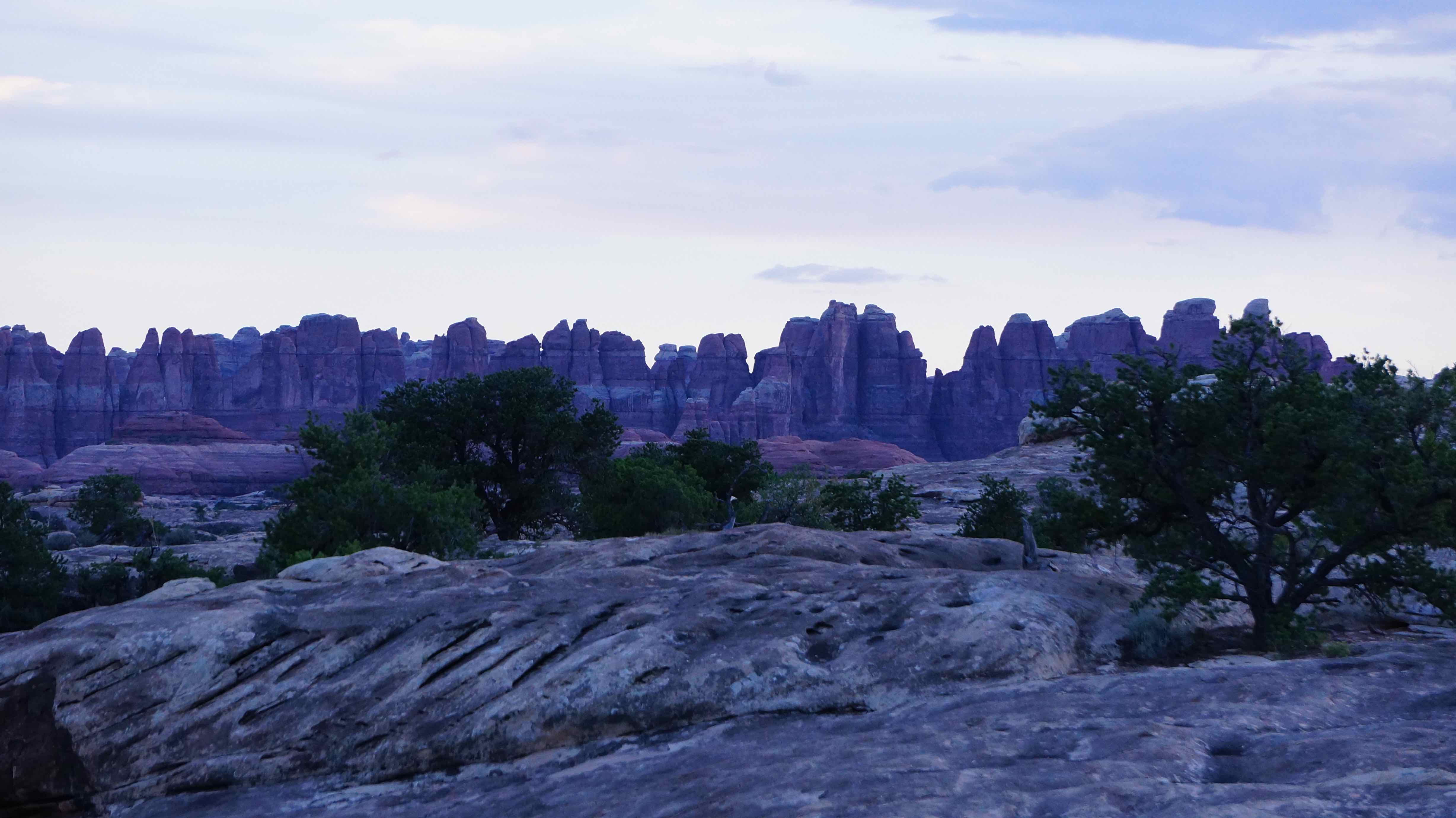
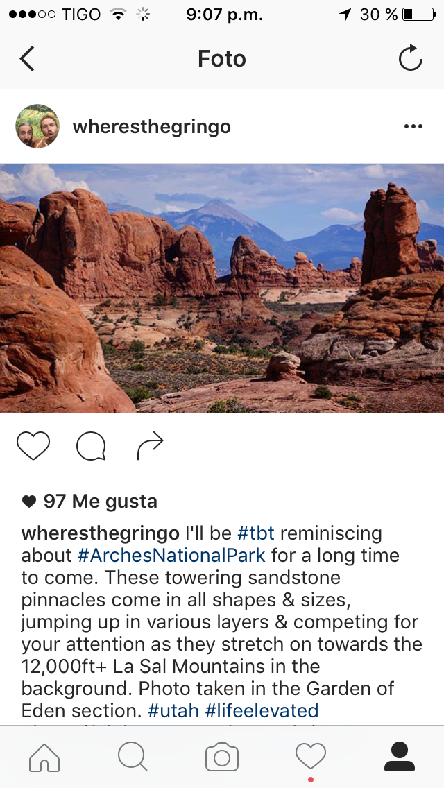
Parque Nacional de los Arcos
You know that huge, red rock arch you’ve seen a thousand times, everywhere from computer desktop backgrounds, to Utah license plates? That’s Delicate Arch, but it’s just one of more than 2,500 natural sandstone arches found in the most iconic of Utah’s national parks.
Arches National Park is also located just 4 miles outside of the extreme sport mecca of Moab, so it’s a no-brainer to stop by & see it. We didn’t have quite enough time to visit all 2,500 arcos, but still left overwhelmed with everything we saw in this little national park.
Suggested time: 1-2 days
Lo que hicimos:
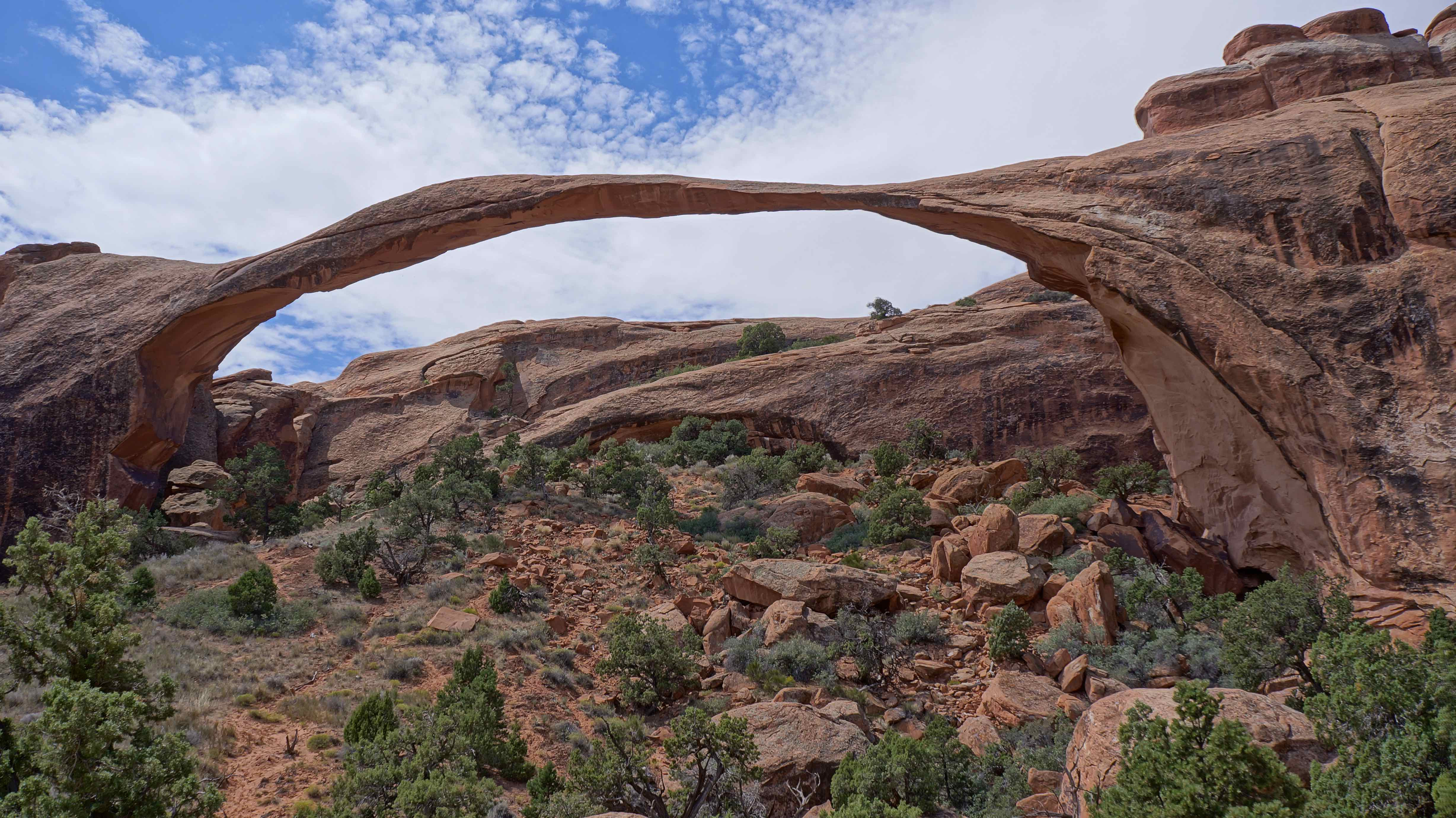
Loop Primitivo Devils Garden – 7.2mi (11.5km). 3-5 hours.
Arches NP is not a huge hiking destination. Most of the arches & views can be taken in from the roads or via short hikes. Habiendo dicho eso, Devil’s Garden is THE trail to hike in the park, y cuanto más lejos se vaya, the crazier stuff you see. Here’s some of the sites we ohh’d and ahh’d at:
Arco del paisaje – el arco más largo en el parque, esta espectacular formación rocosa parece desafiar la gravedad en sí, ya que se extiende a lo largo 290 feet from end to end! Huge chunks have fallen from this arch in recent years, así que es sólo cuestión de tiempo hasta que todo se derrumba el shebang. Go see it now!
Doble-O Arco – También se encuentra en sendero circular jardín del diablo. Looking through the upper arch appears to be a window portal into another dimension (Stargate anyone?). Climb up the hill on the far side of the arch for the best vantage point.
The Windows Section
A unique section of the park that has countless sandstone towers to flank the many arches. Don’t miss seeing:
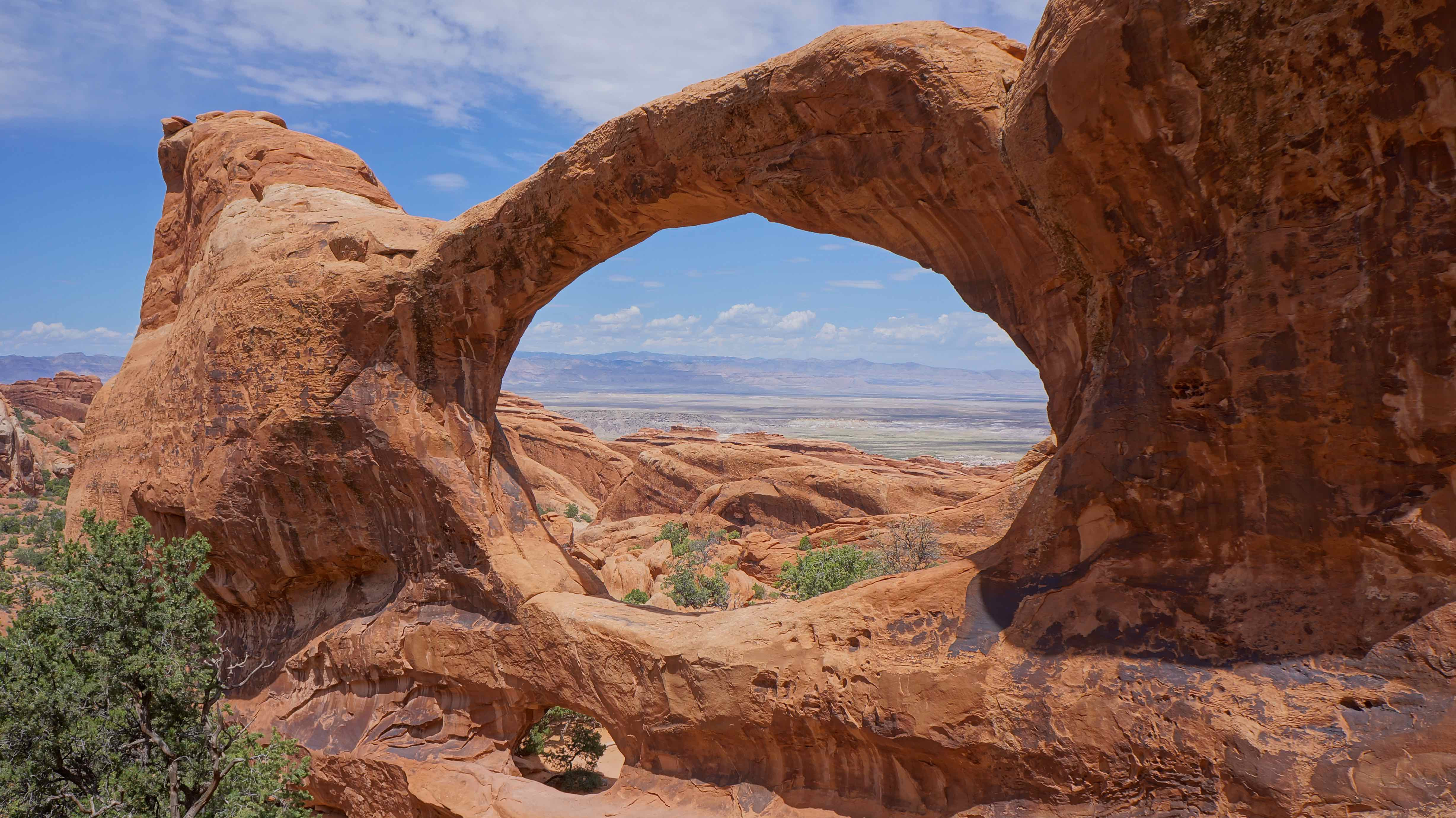
Ventana del norte / sur de la ventana Arco
Absolutely massive, de lado a lado de los arcos que ofrecen grandes vistas a cualquier persona dispuesta a ampliar su escala.
The Garden of Eden viewpoint
¿Dónde nos quedamos:
Hemos encontrado un camping increíble abajo Gemini puentes de carretera. About 5 millas más allá de arcos NP, gire a la izquierda en la BLM 261, cruzar las vías del ferrocarril, y tomar otra izquierda sobre el Gemini puentes de carretera. It’s a popular 4×4 ruta, pero no tuvimos ningún problema en nuestra 2WD Tacoma. Go a few miles down the road, hacia arriba y sobre la cresta, y acampar en los cañones, fo’ free. Or, more traditional campers can opt to stay in Devil’s Garden Campground, located in the park near the loop trail.
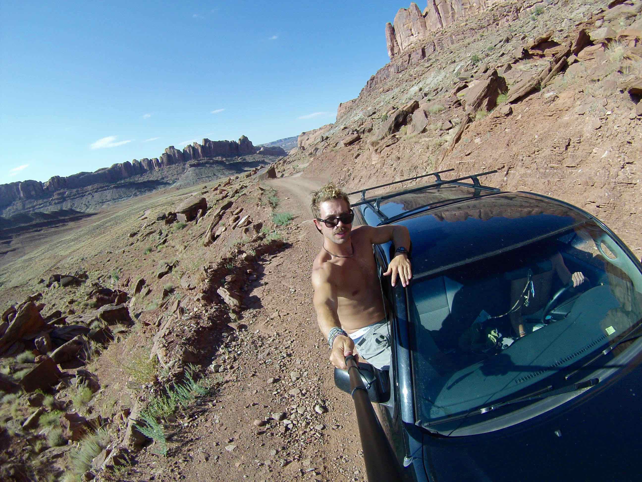
Getting an early morning start down Gemini Bridges Road.
Sego Canyon Petroglyphs
Instead of stopping at the popular Dead Horse State Park like most people do on their travels between Utah’s national parks, we opted for a lesser known & far odder pit stop – el Sego Canyon Petroglyphs.
Cabeza fuera de los arcos y dedicarse a 25 millas al norte en 191, a continuación, en dirección este por la I-70 a unas pocas millas para salir 187 Thompson Springs. About 3.5 norte millas de la ciudad de Thompson, you’ll enter into a canyon with perhaps the weirdest rock art you’ve ever seen.
I’ve done my research on this place since going there, and I’m actually completely wrong in this video. Although there are petroglyphs at this site from about «1,000 años atrás» as I mention, particular rock art shown in the video is known as the Barrier Canyon Style Petroglyphs, and date from 6,000 B.C. to 100 B.C., or possibly 8,000 años atrás.
Apparently the people who sketched this into the rock were Archaic, nomadic people who lived in caves & small brush shelters. Scholars suppose that the freaky figures with hollowed-out eyes & antenna-like protrusions represent shamanistic visions produced from trance-like states and rituals.
Or were these Archaic indians leaving evidence of extra-terrestrial activity or alien visitations of the past? You be the judge.
Como he mencionado antes, there are other style petroglyphs left at this site as well, particularly from the Fremont Indians (600 A.D. to 1250 A.D.) & Ute Indians (1300 A.D. to 1880 A.D.), but in my opinion these trippy alien drawings are the best.
Suggested time: 1-2 hours
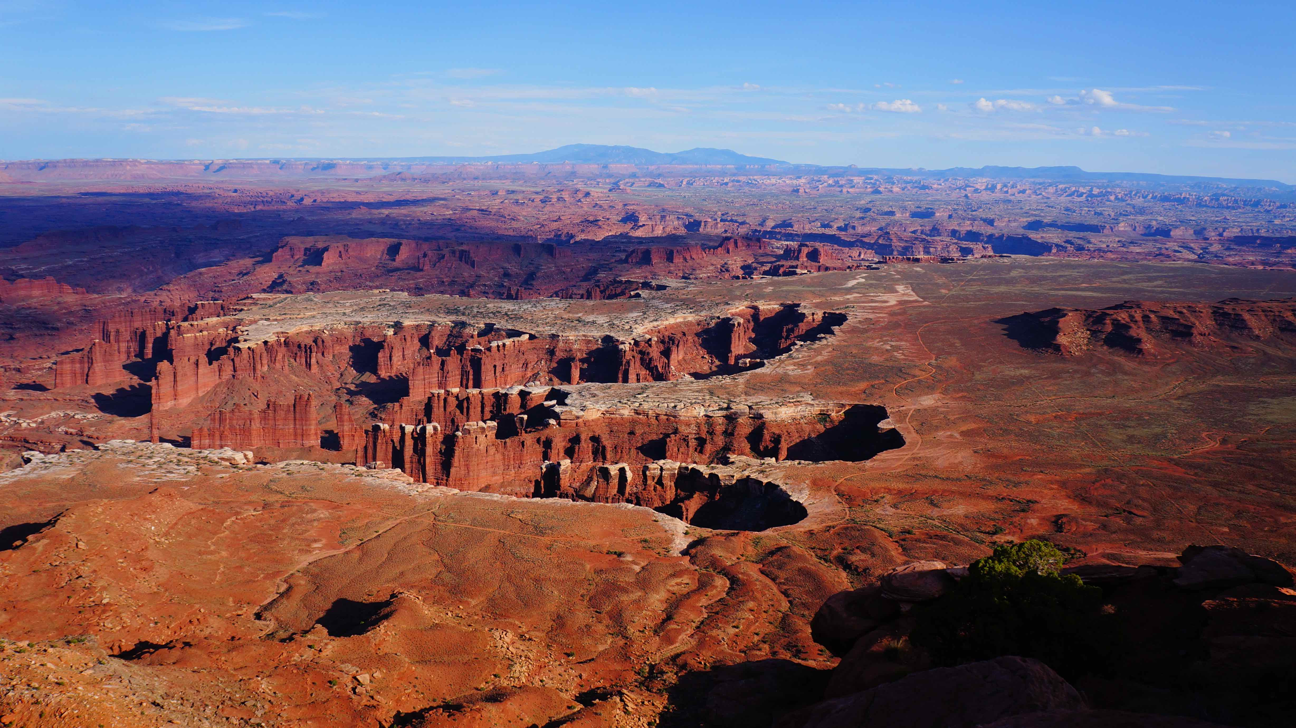
Parque Nacional Canyonlands – Isla en el distrito del cielo
Posados miles de pies con vistas a la confluencia del río Colorado y el Río Verde, the Island in the Sky district offers amazing views at any time of the day, aunque las horas del amanecer y atardecer son las estrellas del espectáculo.
Suggested time: 1-2 days
Lo que hicimos:
Comer el almuerzo en el Grand View Point Overlook hacia la cuenca del monumento.
Es que la huella de Godzilla o qué?
Puesta de sol en Green River Overlook
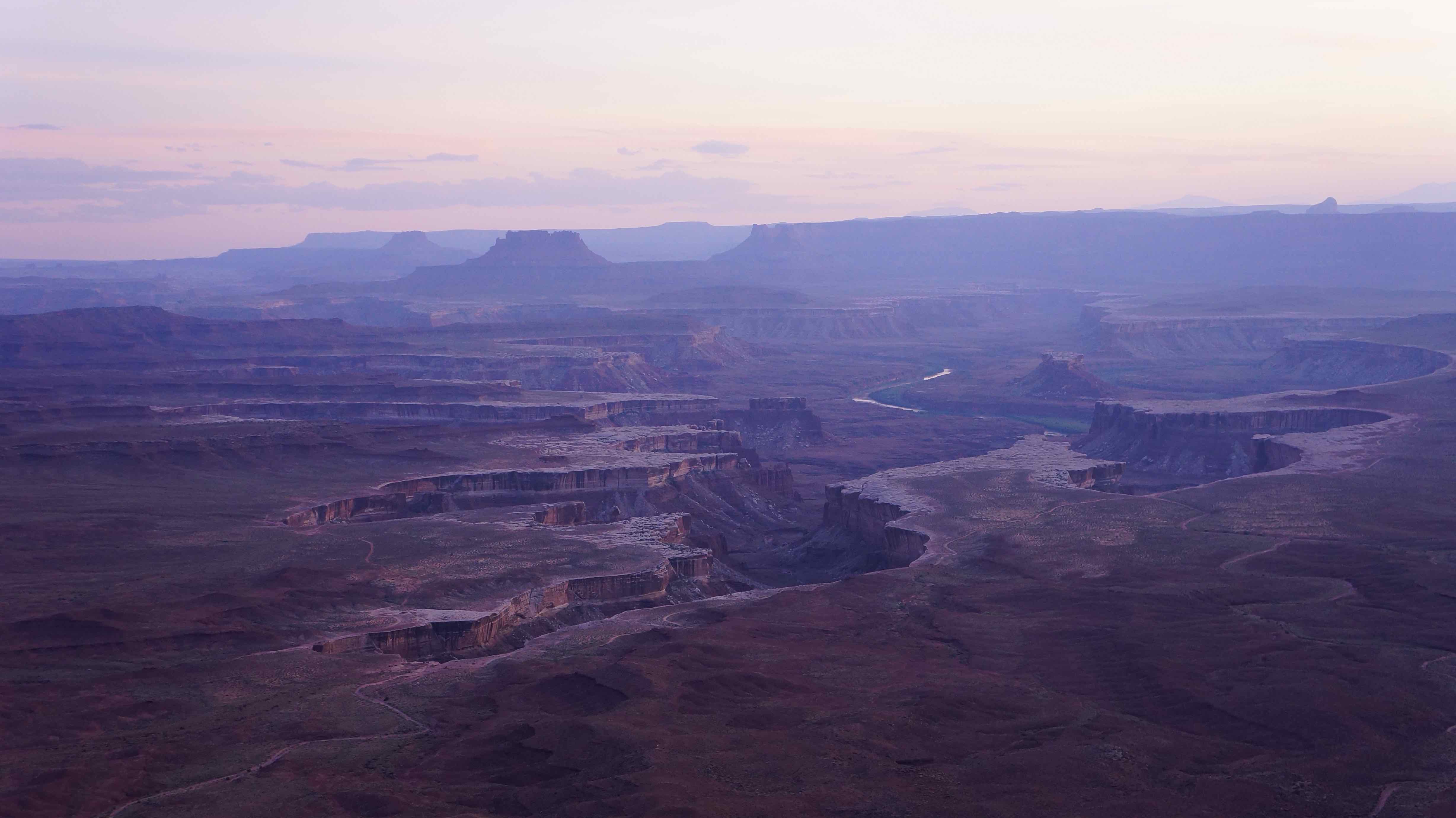
Cuando el sol se hunde cada vez más en el cielo, shadows stretch and grow to alter your depth perception of the canyon walls, mientras que otros niveles de formaciones rocosas mutar y cambiar de forma ante sus ojos. It’s here, más que cualquier otra parte del parque, dónde «Isla en el cielo» está a la altura de su nombre.
Salida del sol en Mesa Arch
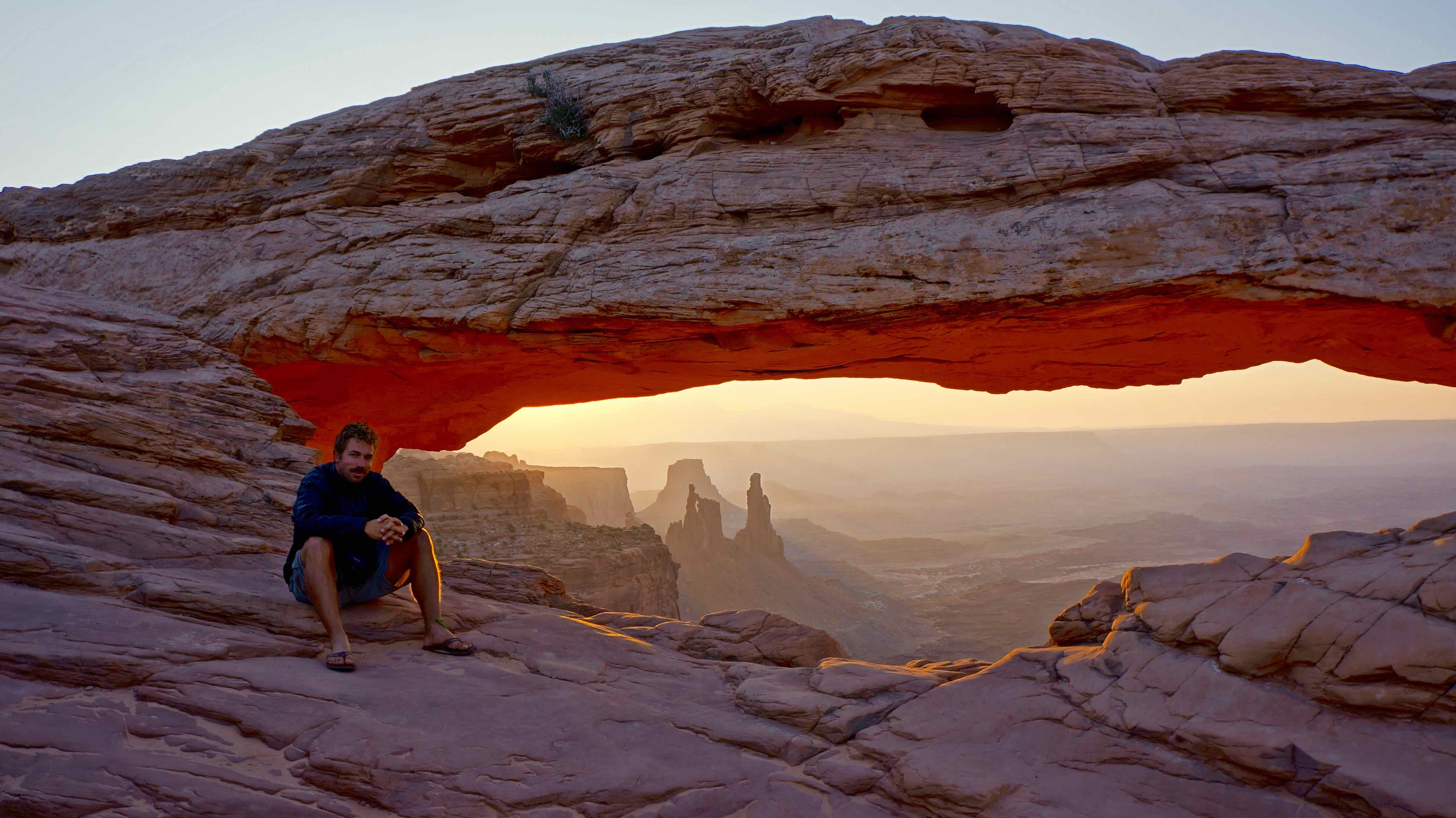
El sol sale por el horizonte, iluminando la parte superior, inner rim of Mesa Arch like a giant, bobina de calor natural. The background ain’t too shabby either. Si ve una cosa a la isla en el cielo, hacen que este.
Tip: get there bright and early. It seems that more & more shutterbugs come every day to fight for the best vantage point of the arch and the few precious minutes when it’s most picturesque. I almost threw a rude & particularly over-assertive Chinese lady’s camera tripod off the mountain.
¿Dónde nos quedamos:
Una vez más, optamos por la opción libre de acampada BLM. Directly outside of the entrance to the park, primitive campsites can be found along the BLM 129 y BLM 340 carreteras. We just pulled over and camped – nadie, sin preguntas, gratis. Those wanting more services & un ambiente de camping se puede comprobar a cabo Horsethief Campground.
Parque Nacional Bryce Canyon
«Just how cool can Bryce Canyon be?»
We were driving west, and had just left a place called Canyonlands, so I wasn’t too optimistic for more canyon-inspired awe. But after stepping up & looking out over the Anfiteatro section of the park, my doubts instantly melted away.

Bryce Canyon del infame «Anfiteatro»
Suggested time: 1 day
Lo que hicimos:
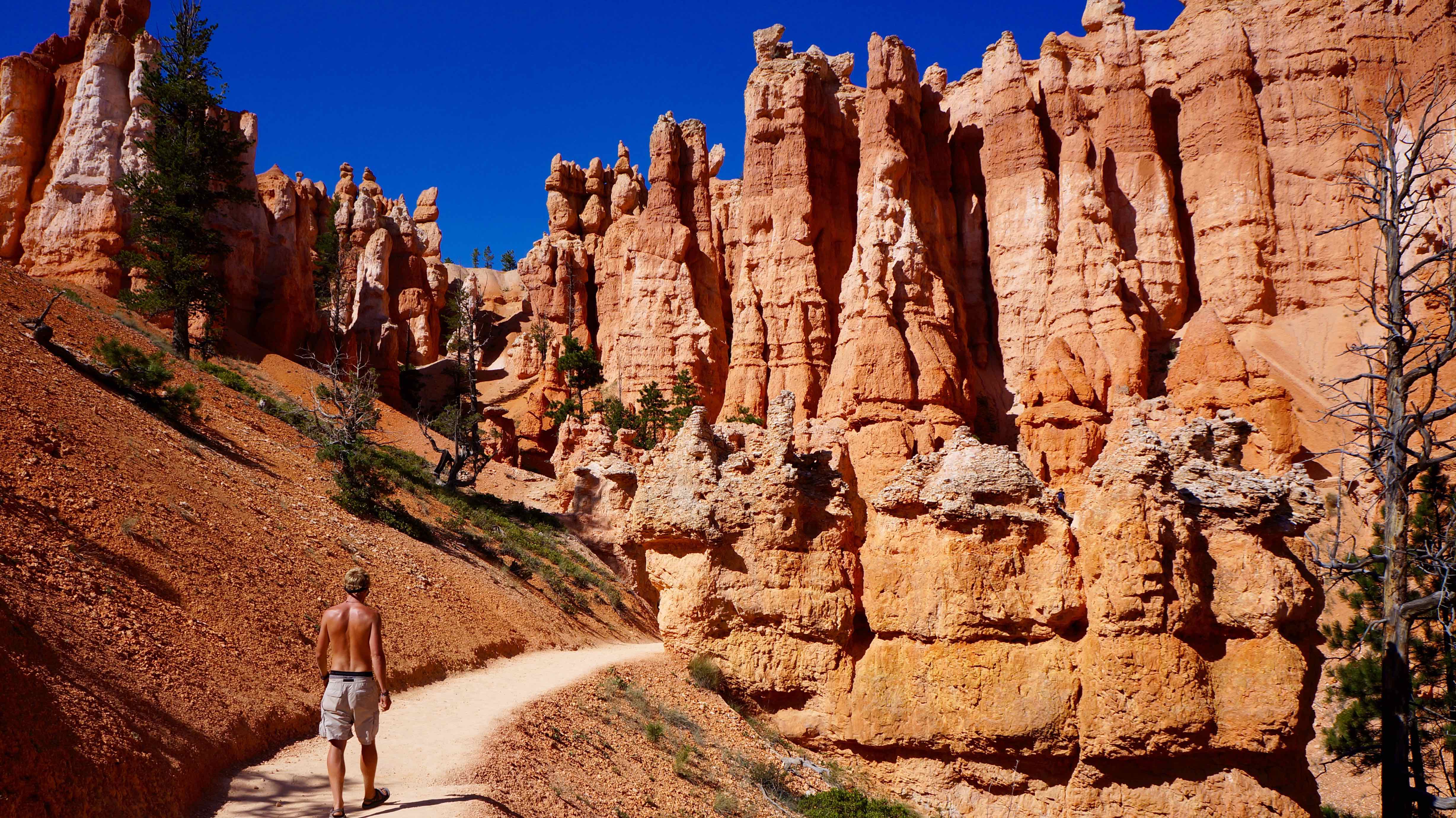
Navajo Loop Trail
The main hiking trail of the Amphitheater section of Bryce, this 3.5 millas (5.6km) mile loop requires minimal effort for a maximum reward.
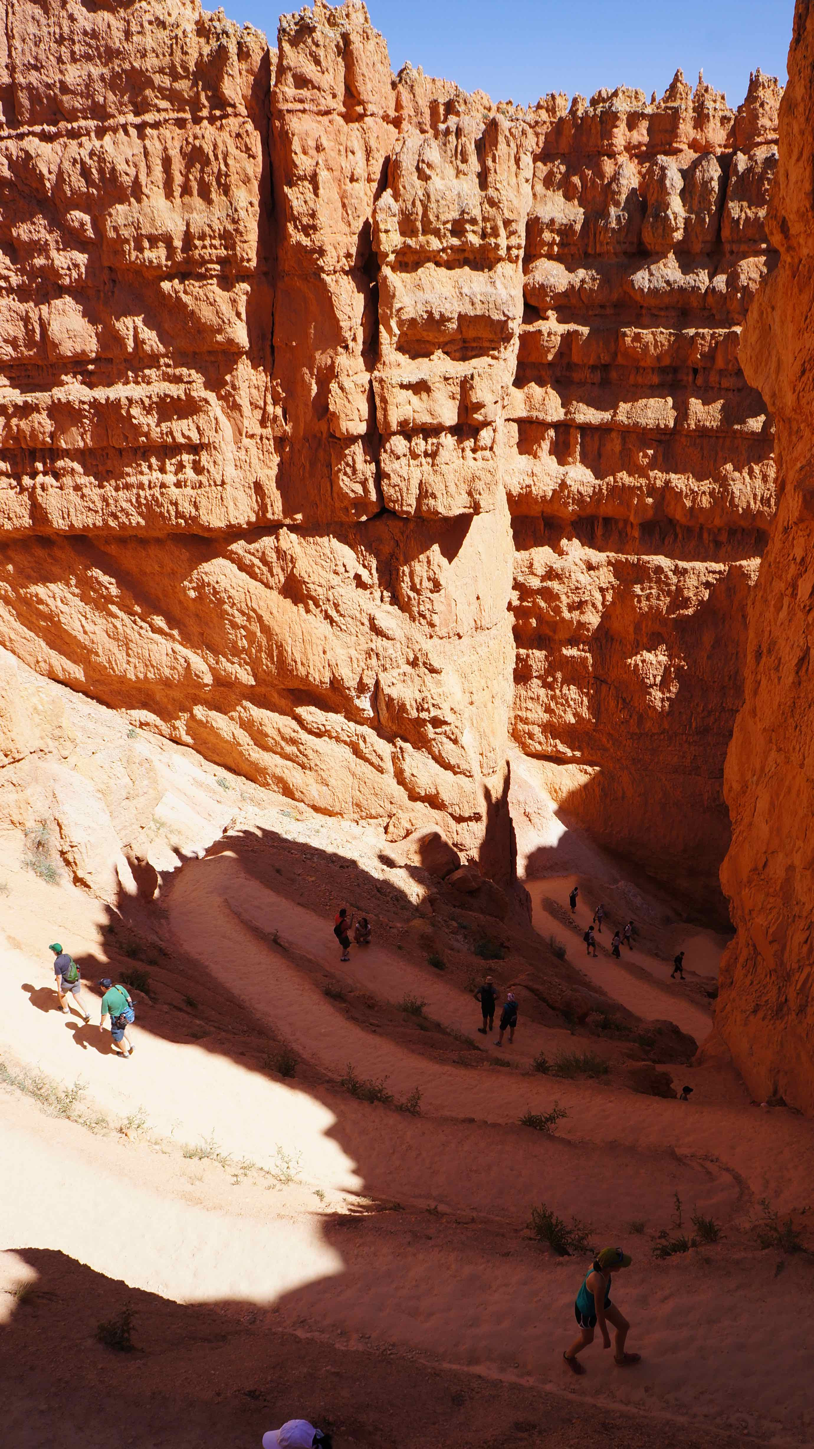
En esta sección se llama Wall Street, and hiking it was the closest I’ve felt to being in the movie Honey I Shrunk the Kids. The path snakes back & forth down into the shadowy depths of the canyon as the sandstone, hoodoo rock formations close in around you.
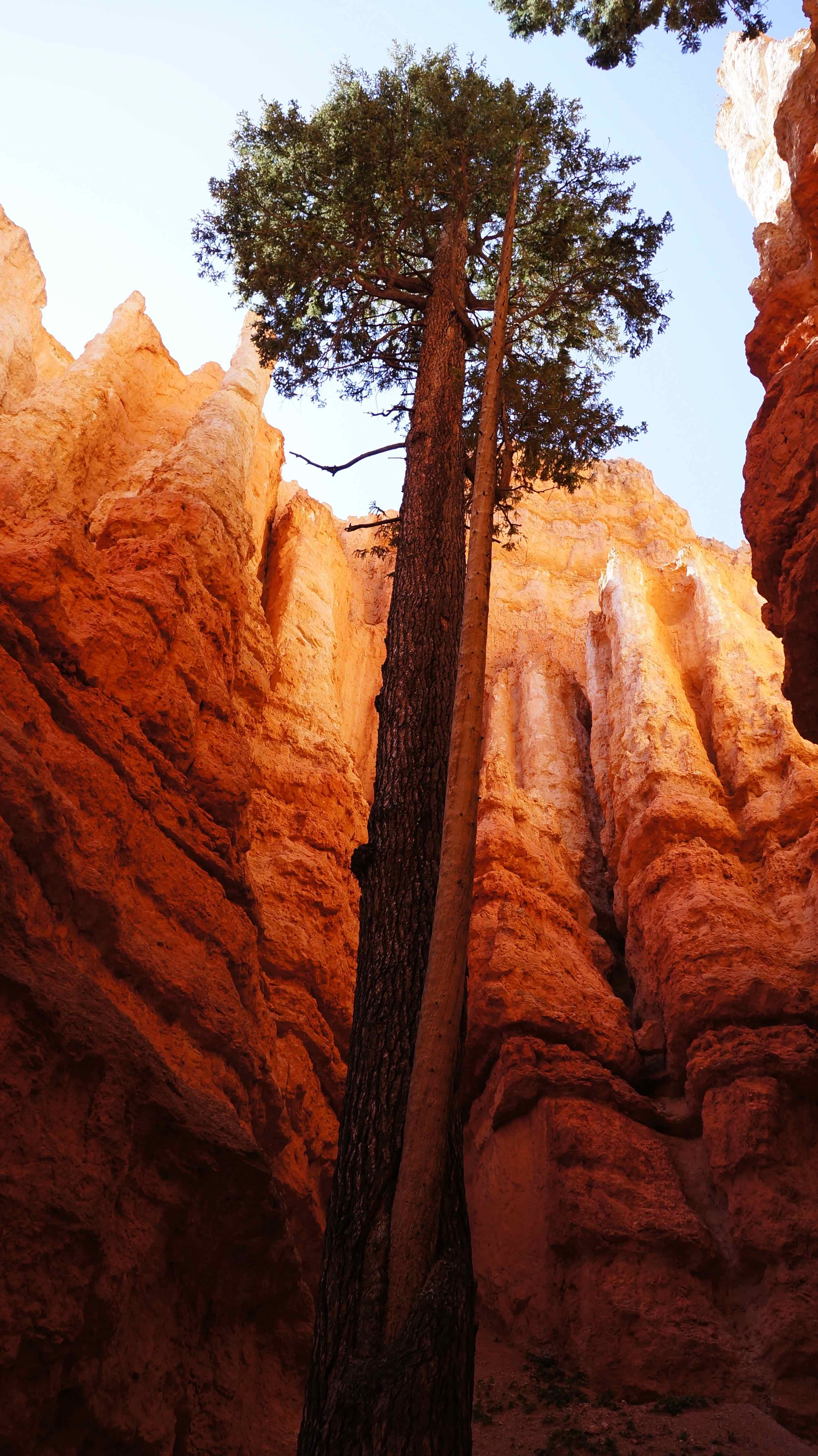
estos roja, naranja, & blanco hoodoo agujas (formado por Gelifracción & la erosión del agua) crowd around the winding path as masses of people mill around (this is a busy hike), making you look around & pregunto si estás en una granja de hormigas gigantes! It’s a pretty neat experience.
¿Dónde nos quedamos:
Hicimos Bryce en un día, and drove on to spend the night outside of Zion. los North and Sunset Campgrounds are both pretty solid options for those wanting to stay in the park to explore more.
Zion National Park
Had to save the best for last. Of all of Utah’s national parks, Zion tops them all. It’s quite simply one of the coolest places I’ve ever been. Zion is crazy & extraño & hermosa. Zion is visually breathtaking. Zion is epic, but like, the proper usage of the word epic (your omelet is not «épico,» bro).
Suggested time: 3 days
Lo que hicimos:
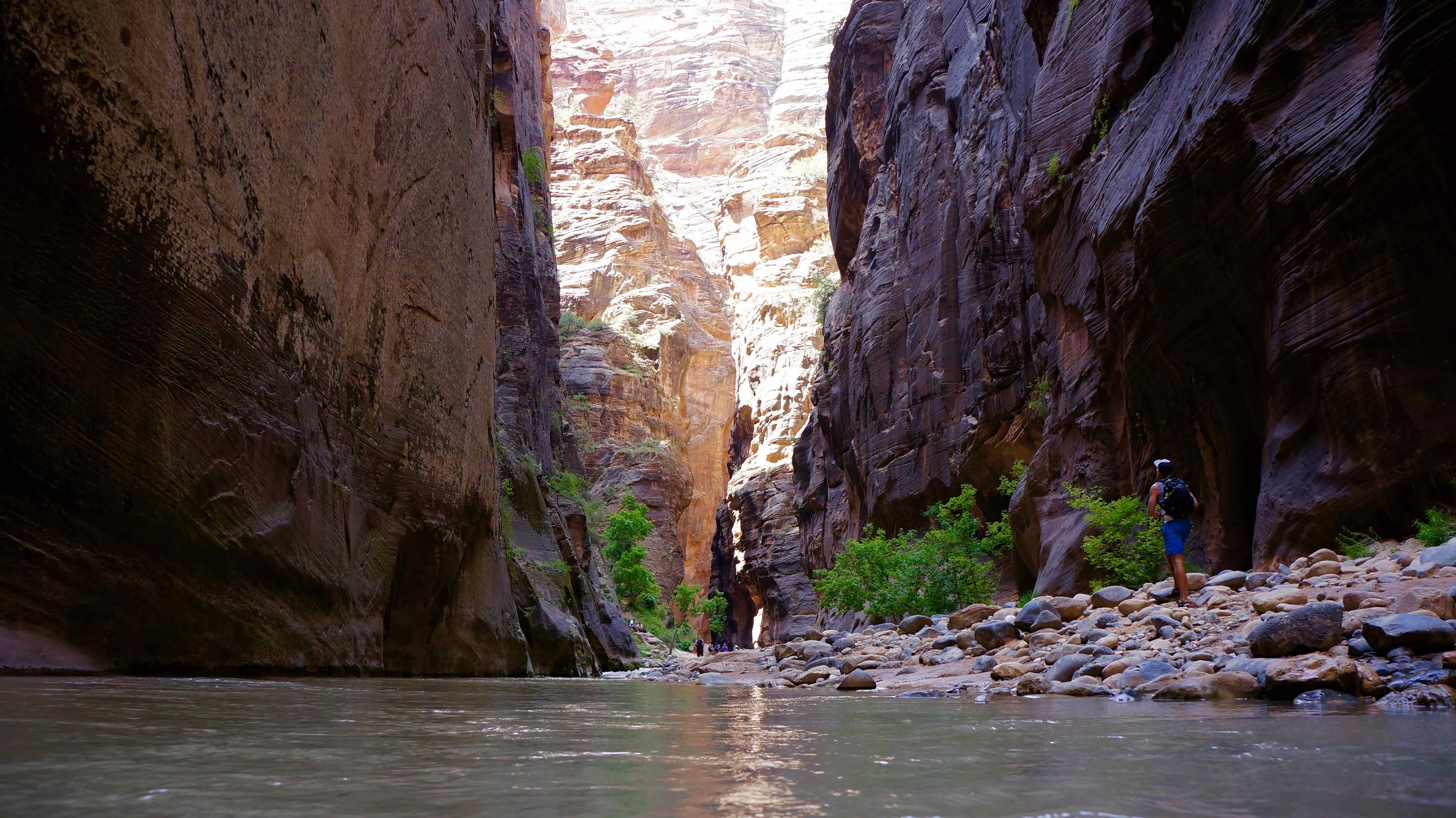
The Narrows
Un derecho de paso para cualquier ávido excursionista, The Narrows is the most photographed and famous slot canyon in the world. Imagine the mind-boggling perspective of walking up a river that narrows to 30 feet in some places, with walls that shoot up towards the sky reaching 2,400 pies de altura. Just think about that for a second.
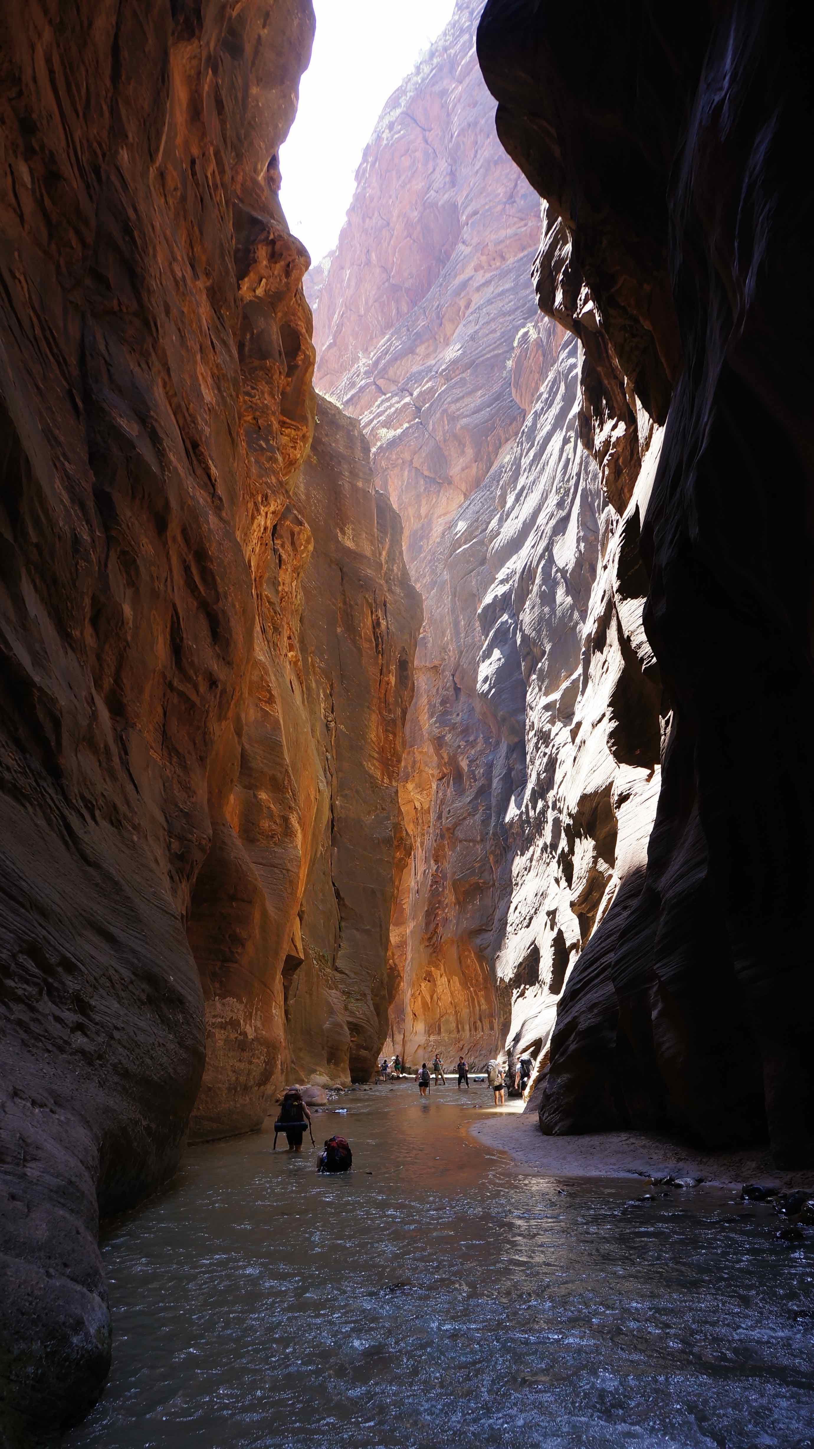
The Narrows can be enjoyed a variety of ways, although most hike it from the bottom-up which does not require a wilderness permit. Hikers can turn around whenever the wish, but the adventurous day hikers should plan on 4-9 hours of hiking as you can trudge 5+ miles through the river up the canyon before turning around. The really adventurous who wish to hike the entire 16 miles of the Narrows must do so from top to bottom, which requires a wilderness permit & more than likely 2 day excursion.
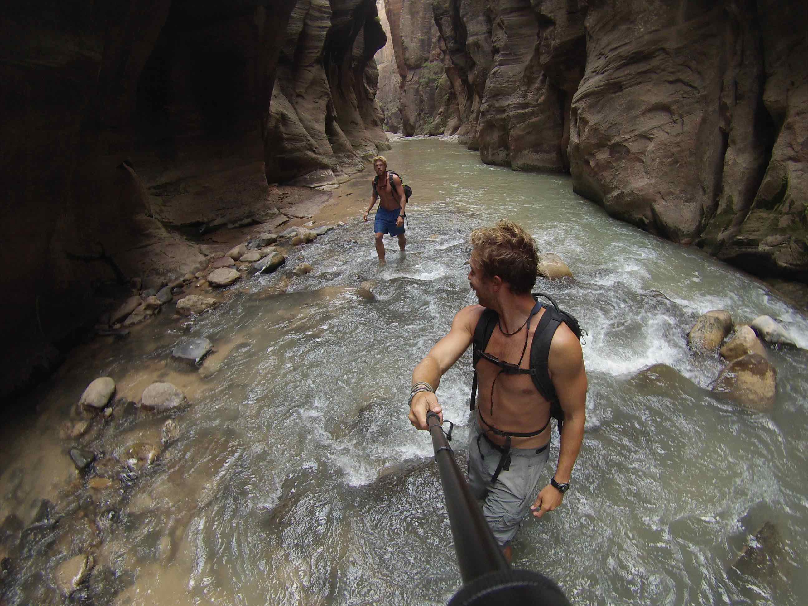
Tip: Do not wear hiking boots, nor sandals on this hike! You are slogging through a murky water river for miles, and will need solid footwear that protects you & doesn’t weigh you down. Trail runners or a solid pair of Chacos should do the trick, but beware of rocks with open-toe footwear. Footwear rental (as well as waterproof clothing & hiking pole rentals) can be procured via Zion Adventures Company. The water is cold, so renting waterproof clothing should be explored in the cooler months, but using a hiking pole is ALWAYS recommended as twisted ankles & broken bones are not uncommon.
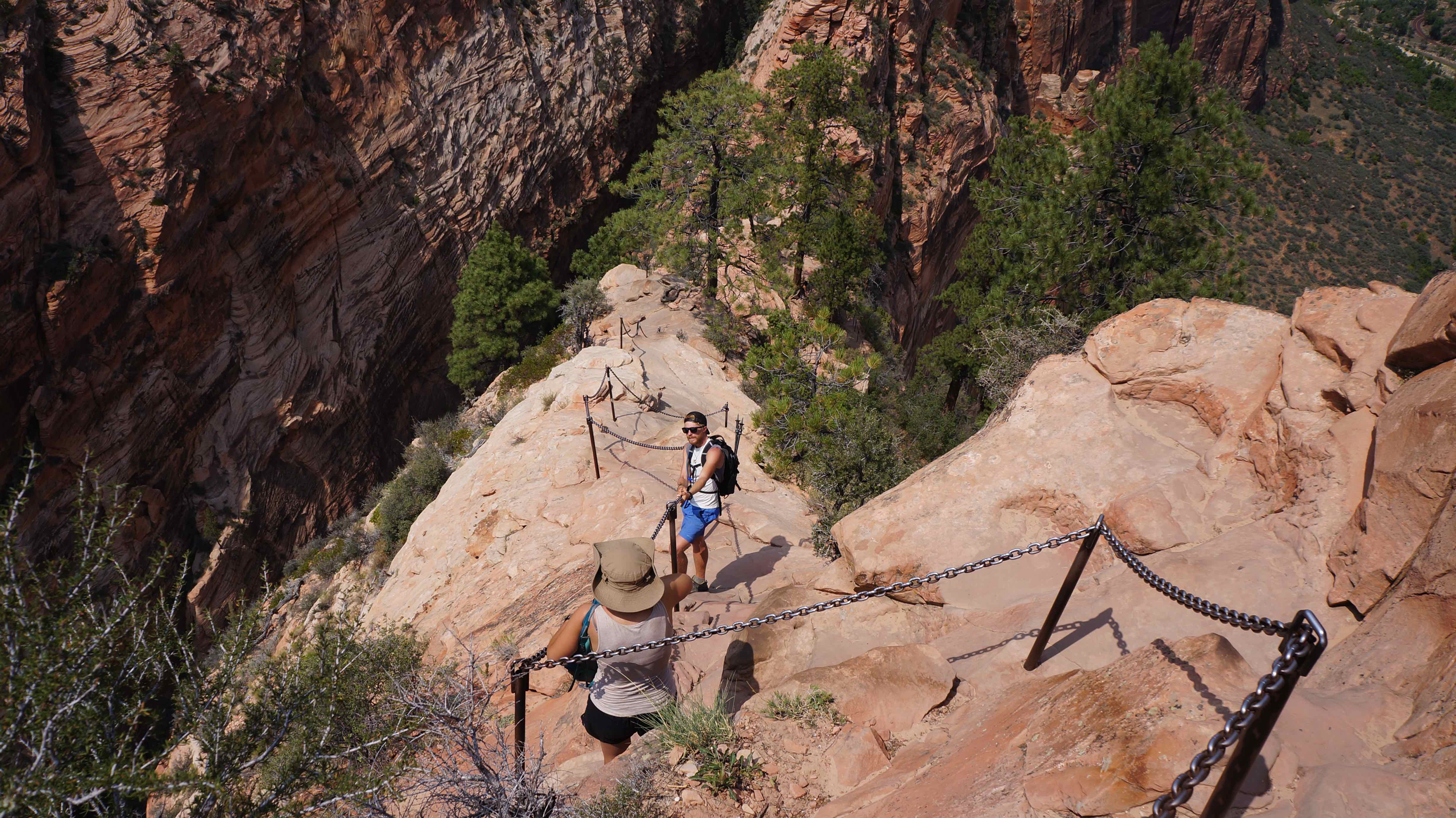
Angels Landing
Consistentemente denominado como una de las mejores excursiones en los EE.UU., Angel’s Landing is not for the faint of heart (leer: anyone with a fear of heights).
Over the course of 3.9 km (2.4 millas), hikers ascend a shirt-drenching 1,488-feet (454 m) in elevation. In layman’s terms, that means it’s steep as shit. After the first 45 minutes of tame cutbacks on a paved path, the fun part begins. Get ready to tiptoe up the spine of a gigantic sandstone fin of a mountain.
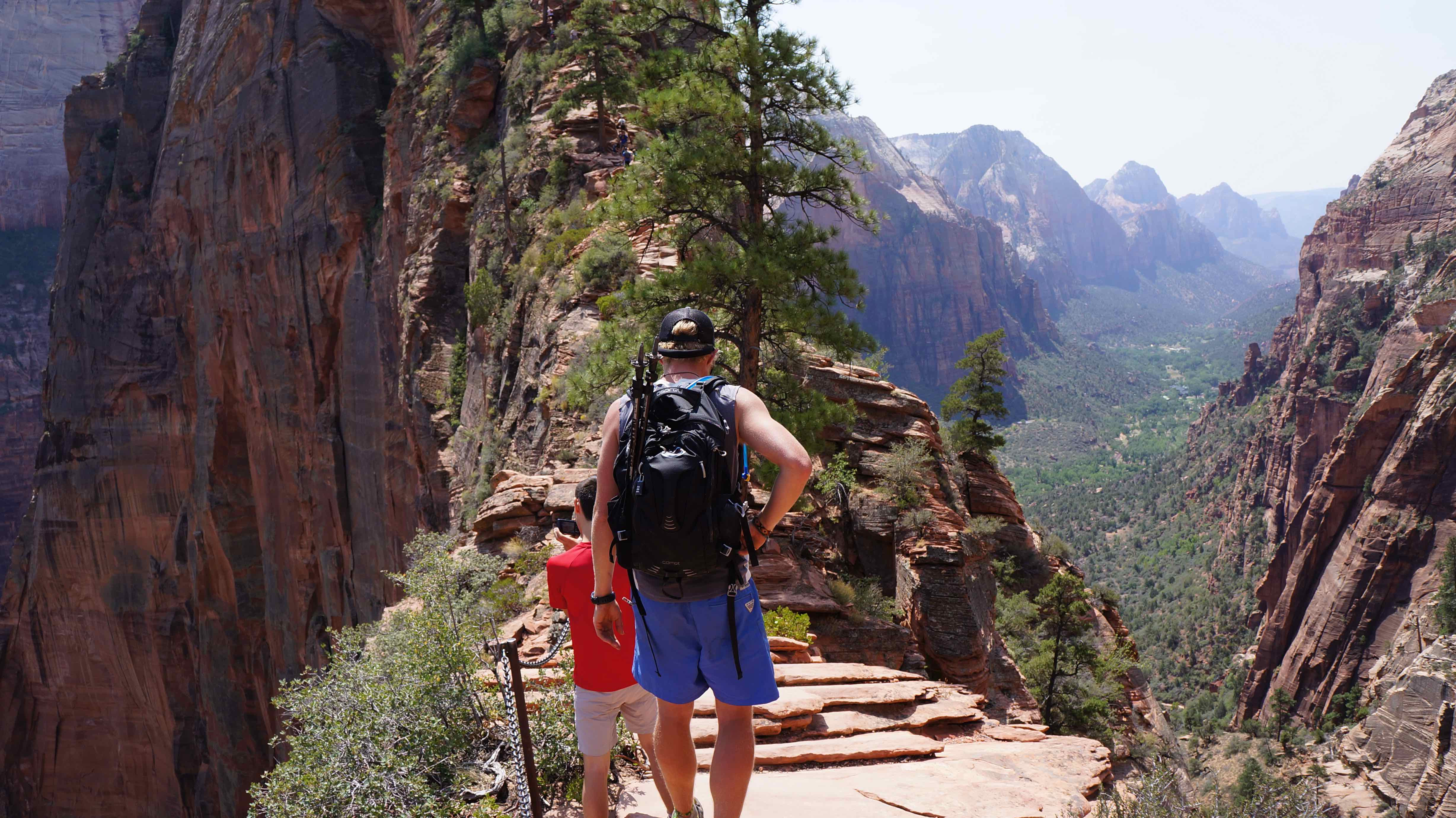
But don’t worry, it’s not as scary as it looks. There are staircases cut into the rock, and steel chain hand rails bolted deep into the mountainside to ensure even the most unsure-footed of hikers don’t slip and fall. Habiendo dicho eso, there are usually at least a few deaths every year, so don’t get too comfortable!
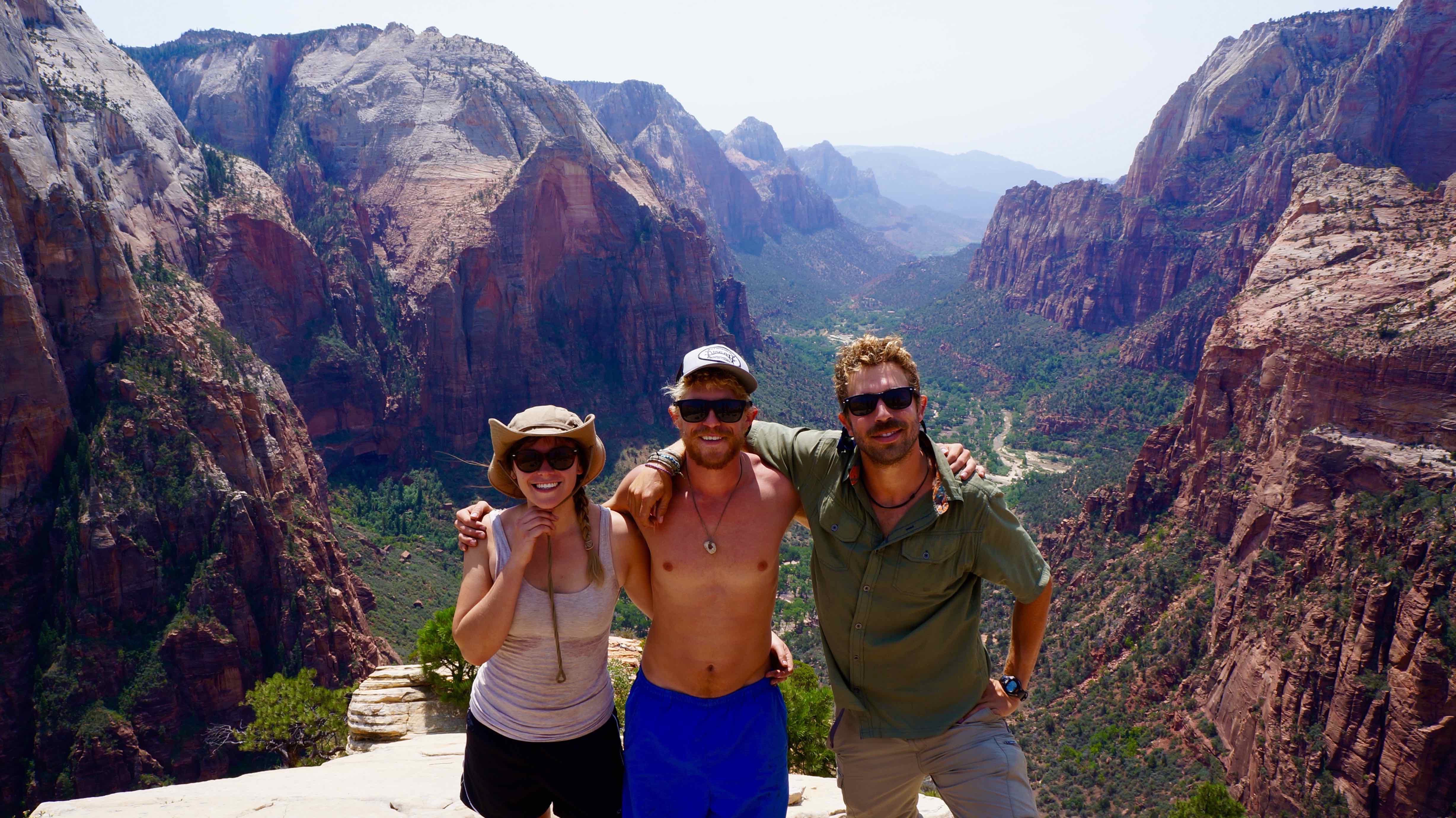
Those bold enough to brave the heights will be rewarded with what will surely be one of the best views your eyes have seen…
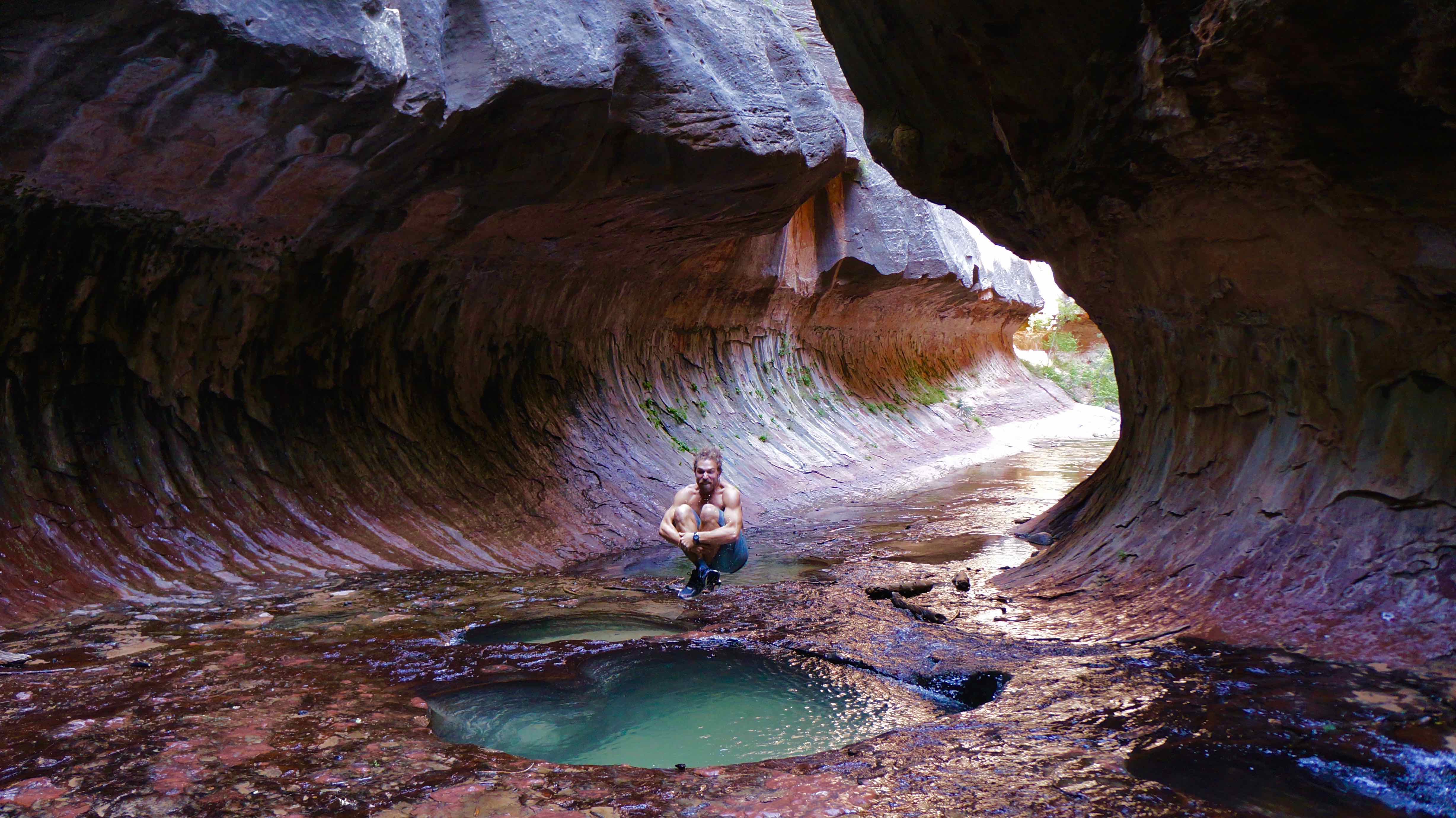
The Subway
The Subway is one of those places that you accidentally scroll past on your Instagram feed, only to double back, blink your eyes a few times, and then let out a «What the….that place is real?»
This cylindrical slot canyon is a natural phenomenon that has to be one of the most picturesquely formed geological formations on Earth. It’s much more secluded than the Narrows, and significantly more technical & intense. The hike is about 10 miles long, will take roughly 7-9 hours to complete, y requires a wilderness permit reservation.
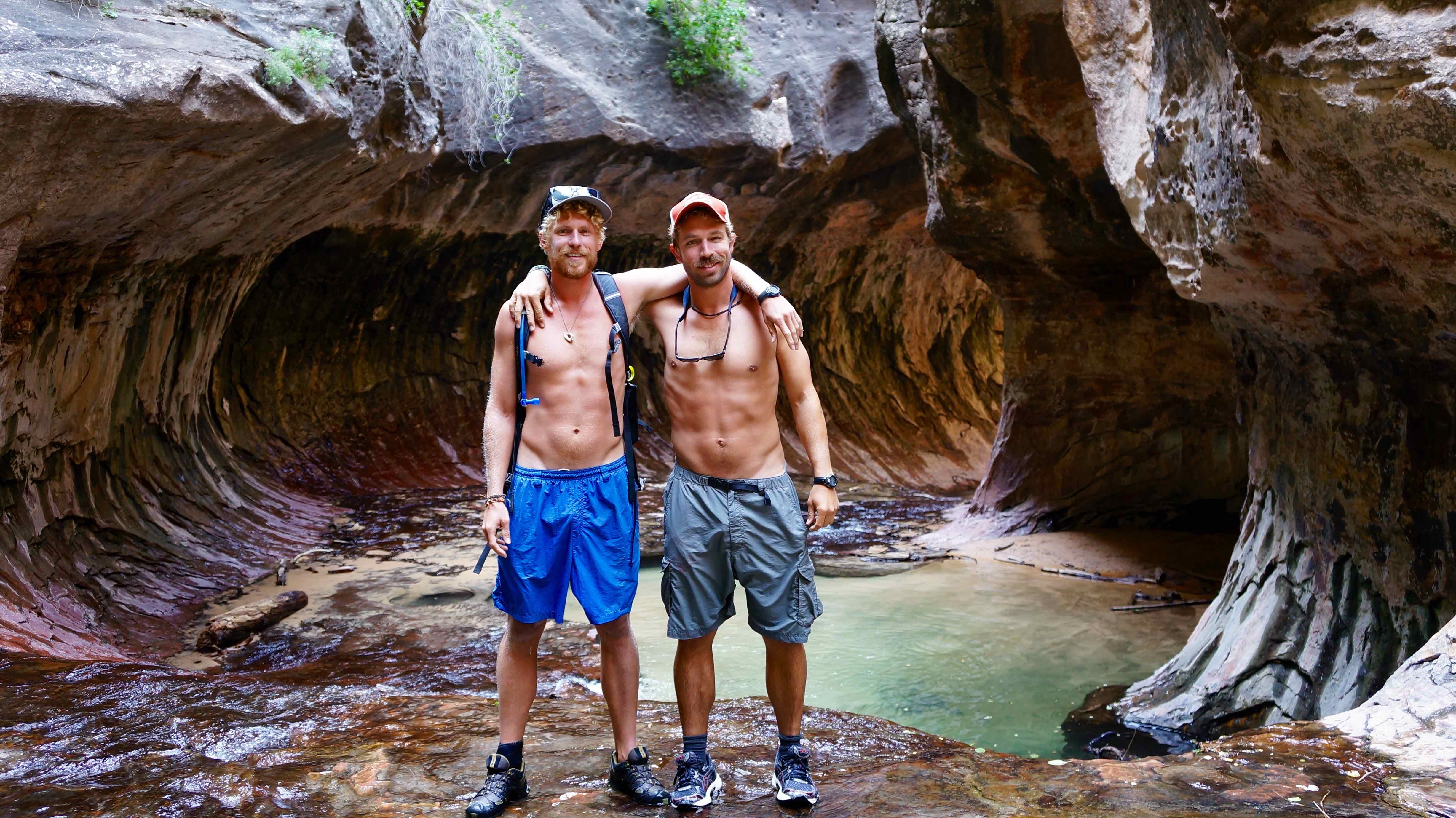
Make your wilderness reservation as soon as possible because daily permits are limited, and the Subway hike is appearing on more peoples’ bucket list everyday due to assholes like me who rave about it.
Tip: They say that the Upper Subway section is limited to those with who hike from the top down with canyoneering equipment, but my brother and I found a way up from the bottom without any gear. Just past the Lower Subway section (the most photographed part) there is a little waterfall gushing into the slot canyon. With a little bit of slippery maneuvering & ballsy scrambling, the Upper Subway can be accessed here as the rocks push close together. It’s totally worth it if you can make it, but don’t chance a 5 mile hike out with a broken leg!
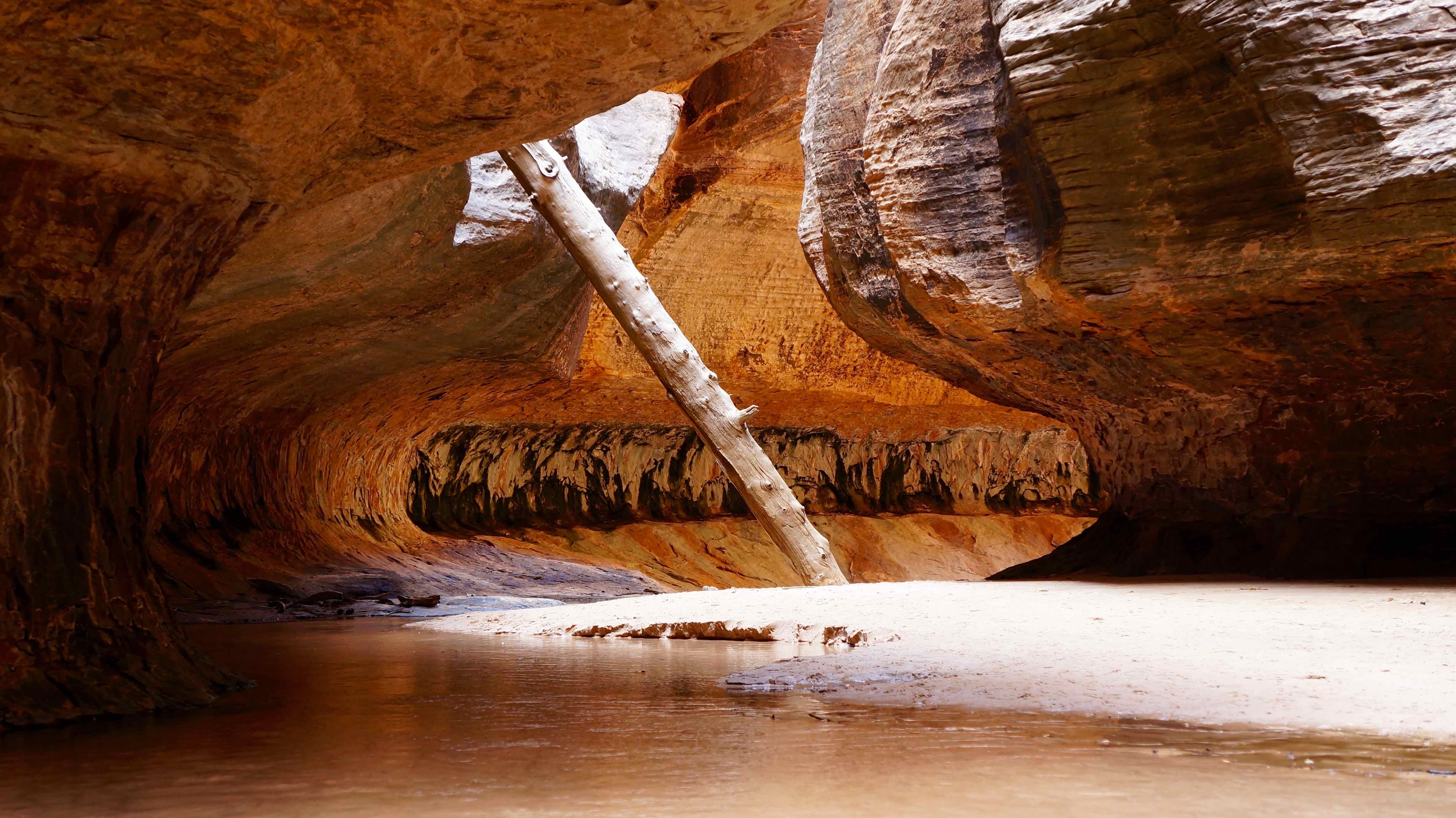
The Upper Subway section. So strange..
¿Dónde nos quedamos:
We stayed at South Campground for $20/night, but the real gem was our primitive campsite that a park ranger was kind enough to inform us of. It’s the type of place that should be kept secret, but since I have like 10 followers, I’ll pass on the word here. In Rockville, take Bridge Road across the Virgin river to Grafton Road and then to Smithsonian Butte Road. Start climbing the mountain (don’t worry 2wd is fine), and take the 3rd right. Follow this dirt road as it winds way out onto the bluff and keep going until you can’t anymore. Unless someones already beat you to it, you’ll have your own, private campsite high up on the cliff overlooking the town of Rockville and the entrance to the park. Amazing.
Utah – Tierra o Marte?
I still can’t believe the strangely amazing landscapes that the state of Utah offers.
Montana has the lakes & glacier-chiseled mountains. Wyoming has the imposing, granite pinnacles of the Wind River Range & the Tetons. Colorado has the 14’ers. But Utah? Utah has something other wordly. From its mountains and deserts to its slot canyons, strange rock petroglyphs and everything in between, Utah’s diversity can’t be matched.
We didn’t even make it to Dead Horse State Park or Capitol Reef National Park, but the places we did go were enough to confuse me as to what planet and drugs I was on (just kidding mom).
The state of Utah’s tourism board’s slogan is «Life Elevated.» You see it on every license plate, on billboards, in magazines. I’ve tried my best to capture this essence of Life Elevated in my photos & videos, but only when you come visit the great state of Utah for yourself will you truly understand!
Essential resources for planning your own trip to Utah
Utah Office of Tourism: http://www.visitutah.com/
Overview of Utah’s National Parks: https://utah.com/national-parks
National Park Service site – Utah section: https://www.nps.gov/state/ut/index.htm
List of campgrounds in Utah: https://utah.com/camping
BLM (Bureau of Land Management) Utah: http://www.blm.gov/ut/st/en/prog/recreation_home/activities/camping.html
Gas Buddy – Find the cheapest gas stations in Utah: http://www.gasbuddy.com/
Jucy Mini & Affordable RV rental: https://www.jucyusa.com/
Have you ever been to Utah’s National Parks? What is your favorite place in Utah?
Hi Ford, I truly enjoy your where’s the Gringo segments. You have your mom’s adventurous Spirit full blown!
Thanks Sammie. Yea, mom made sure Casey and I had the itch ever since we were kids, and for that I’ll always love her. Thanks for following along!
Merci pour le partage
I’ve never been to Utah or even considered going – but you have me convinced. It looks absolutely spectacular, thank you for sharing.
Gracias! Def go and visit, you won’t be disappointed!